Last updated June 24, 2026
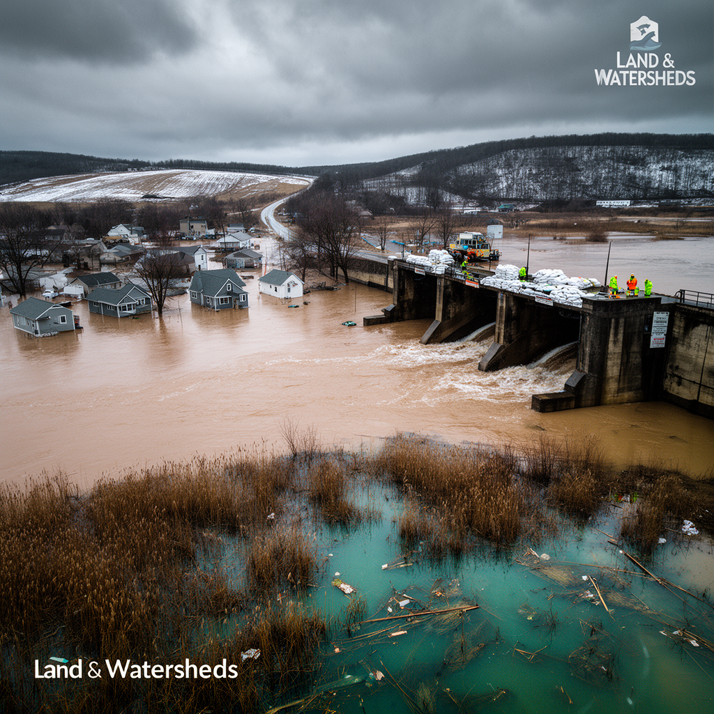
In April 2026, northern Michigan recorded some of the most severe flooding in living memory. Record March snowfall, then record April rain falling on top of it, overwhelmed creeks, rivers, lakes, and the aging dams meant to control them. Dozens of counties went under a state of emergency, homes were gutted to the studs, and at the Cheboygan Lock and Dam the water climbed to within five inches of the crest before crews pulled the complex back from failure. Months later, the cleanup continues and the harder questions (about dam maintenance, floodplain mapping, and who is actually at risk) remain unresolved.
The 2026 event was, in hydrologic terms, a textbook rain-on-snow disaster. An enormous mid-March blizzard left a deep snowpack across the state. Then spring arrived warm and wet, with days of extreme precipitation landing directly on that snow. The combination of warm air, rain, and a melting pack delivered far more water to the landscape, and far faster, than gradual melt would have. Runoff spiked, soils saturated, and channels could not keep up.
The setup had a clear moisture source. Much of the precipitation that reaches the Great Lakes originates in the Gulf of Mexico, and in spring 2026 an unusually warm Gulf primed the atmosphere to carry more moisture north. University of Michigan climate scientist Richard Rood described the Gulf conditions as "extraordinarily warm," noting that a warmer atmosphere holds more moisture for longer, which loads the dice toward heavy rain or snow once enough accumulates. For the March 1 to April 15 window, Michigan and Wisconsin sat at the center of the wettest conditions in a precipitation record going back to the 1890s.
For practitioners, the most sobering framing came from the state's National Flood Insurance Program coordinator, Matthew Occhipinti, who called it "truly a monumental flood" that in many areas exceeded the 100-year event (the flood with a 1 percent chance of occurring in any given year). That is the design threshold a great deal of infrastructure and regulatory mapping is built around, and large parts of the state blew past it.
The flood's most acute danger was not the water in the streets but the water behind aging dams. At the peak, the dam safety unit within Michigan's Department of Environment, Great Lakes, and Energy (EGLE) was monitoring roughly 40 dams that threatened to fail. Several small, low-hazard dams in the northern Lower Peninsula and the Upper Peninsula were destroyed outright. Larger structures in Cheboygan, Hesperia, Bellaire, and other communities came within inches of disaster.
The Cheboygan Lock and Dam became the centerpiece. The state of Michigan owns the dam itself, but the adjacent hydroelectric plant (housed in a former Charmin toilet paper mill) is privately owned and had fallen into disrepair through a long succession of owners. That plant matters for flood safety because it is part of the complex's ability to pass water downstream. With the plant nonfunctional, the dam's discharge capacity was reduced precisely when it was needed most, and the pool rose to within five inches of overtopping. Residents downstream of the structure, including downtown Cheboygan, were urged to prepare to evacuate.
What averted a breach was, by the accounts of officials, a near-last-minute scramble: an estimated 75 Consumers Energy workers repowered the privately owned hydro plant, restoring enough capacity to pass floodwater. Crews then stayed on site around the clock, clearing debris from the gates and watching the upstream Alverno, Tower, and Kleber dams, privately owned impoundments that could have triggered cascading breaches had any of them failed.
Two structural facts here will resonate with anyone who works on dam safety. First, the records show the danger was known: the Federal Energy Regulatory Commission had sent warning letters for years about cracked concrete, damaged retaining walls, malfunctioning gates, and missing inspection records, while granting repeated extensions. Second, beyond the hydro plant, the Cheboygan dam's spillway is simply too small to pass a probable maximum flood, and bringing it up to standard would cost millions.
Michigan has been here before. In May 2020, the Edenville and Sanford dams in the Midland area failed during heavy spring rain, forcing about 10,000 people to evacuate and inflicting hundreds of millions of dollars in damage that taxpayers have largely paid to repair. The parallels to 2026 are uncomfortably close: old, undersized, privately owned dams, poorly maintained, flagged by regulators for years before a spring flood pushed them over the edge.
The state owns a large inventory of these structures (the Department of Natural Resources alone holds 201 dams, part of roughly 2,600 statewide), and DNR leadership has long argued it lacks the money to maintain them adequately. The funding gap is concrete: Governor Gretchen Whitmer's proposed fiscal year 2026 budget sought an additional $15 million for dam safety, but the figure was negotiated down to just under $4 million. Officials and former regulators now warn that without stronger standards and sustained repair funding, the next high-water year will find the same vulnerabilities waiting.
The flood exposed a second systemic weakness that sits squarely in the floodplain-management world: many of the people inundated had no flood insurance and no idea they were at risk.
Part of the problem is coverage of the maps themselves. FEMA has never produced flood-hazard maps for many less-populated areas, including some of the Michigan counties that flooded. Black Lake, a longtime summer and retiree destination, illustrates the patchwork: it straddles two counties, Cheboygan (which has a 2012 FEMA floodplain map) and Presque Isle (where most areas have never been mapped at all). Homeowners there were told flood insurance was unavailable, or that they were not in a flood zone, only to watch knee-high water force them to tear out flooring, drywall, and appliances.
Part of the problem is methodology. FEMA's maps are built primarily around riverine flooding, the overflow of rivers, streams, and other channels. They do not well represent pluvial flooding, where intense rainfall overwhelms stormwater systems in towns and pools in rural areas with nowhere to drain. As rainfall intensity climbs, that blind spot grows. First Street, a firm that models climate-driven financial risk, found more than twice as many properties at significant flood risk nationwide once it incorporated rainfall data and mapped smaller streams that FEMA omits. In Michigan, the company found roughly four times as many at-risk properties as the federal maps show. "FEMA flood maps should always be the beginning of the journey and not the end," as one expert put it.
The federal watchdog agency raised related concerns years ago, warning that FEMA's hazard maps did not reflect the best available climate science or heavy-rainfall risk. FEMA, which declined an interview, noted that 95 percent of the U.S. population lives in mapped areas and described its maps as "snapshots in time." Where coverage does exist and policies are available, the protection is not especially expensive: an average National Flood Insurance Program policy in Michigan runs about $1,000 a year for $250,000 in coverage, though rates vary widely.
The immediate emergency has eased. The State Emergency Operations Center, activated statewide on April 14, was deactivated on May 8. By late April, water at the Cheboygan complex had dropped more than 11 inches below the top of the dam, and recovery had entered its third week. But EGLE's dam safety chief was blunt that the situation was not over: at the time, crews were still on alert, waters had not yet receded enough to inspect many dams for hidden damage, and any large rainfall event could put responders right back where they started.
For a water resources engineer, the 2026 flood reads less like a freak event than a stress test that several Michigan systems failed in predictable ways. The hydrology (rain on a record snowpack, fed by a warm Gulf) is the kind of compound event a warming climate is expected to make more frequent. The dam inventory is old, underfunded, and in key cases privately held with weak enforcement. And the floodplain maps that are supposed to tell people their risk are incomplete in rural areas and structurally blind to rainfall-driven flooding. None of those three failures has been resolved, which is why the people closest to the response keep returning to the same word: predictable.