Standard hydrology methods break down in karst terrain. Water disappears into sinkholes, resurfaces kilometers away through caves, and ignores your carefully calculated curve numbers. Puerto Rico's northern karst covers 27% of the island, sits over a critical aquifer, and makes conventional stormwater design dangerously unreliable.
There is a moment that happens to most engineers the first time they work in karst terrain. You've done everything right. The survey is accurate. The curve numbers are appropriate. The time of concentration is reasonable. The model runs cleanly. You present your design with confidence.
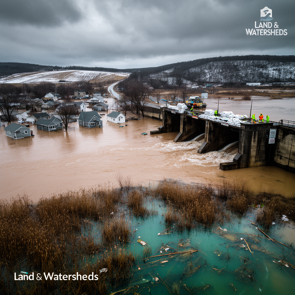
And then someone who has actually watched that watershed during a storm tells you that roughly a third of the runoff you so carefully routed through your storm system disappears into a hole in the ground about 200 meters upstream, resurfaces as a spring two kilometers away, and has absolutely nothing to do with the drainage infrastructure you just spent three weeks designing.
Welcome to karst. Population: your humbled assumptions.
Karst terrain forms where soluble bedrock, primarily limestone, but also dolomite and gypsum, has been dissolved over geological time by mildly acidic groundwater. The result is a landscape riddled with sinkholes, caves, solution conduits, disappearing streams, and springs. The surface looks more or less normal. Underneath, it is a three-dimensional plumbing system of extraordinary complexity that was built over millions of years without any input from the engineering community.
In Puerto Rico, karst terrain covers approximately 27% of the island's total area, concentrated along the northern coastal plain and extending inland across portions of the island's interior. This is not a marginal geological curiosity. It is a dominant hydrologic feature of one of the most densely populated and actively developed regions of the island.
The northern karst belt sits between the central mountain range and the Atlantic coast. It receives intense tropical rainfall, sits above a critical freshwater aquifer, and contains some of the most ecologically sensitive terrain on the island, mogotes, sinkholes, blind valleys, and the cave systems that have formed over the past several million years. It is also, inconveniently, where a significant amount of development pressure exists.
The foundation of most stormwater engineering is the assumption that water moves overland or through the soil profile in ways that can be reasonably approximated by the methods in our standard toolbox: TR-55, the Rational Method, HEC-HMS, SWMM. These tools were developed primarily for surface-dominated drainage systems. They perform well in environments where infiltration is limited, flow paths are relatively predictable, and the relationship between rainfall and runoff follows the patterns embedded in their calibration datasets.
In karst, the plumbing is underground, the flow paths are three-dimensional, the travel times are highly variable, and a significant fraction of the water budget can move through preferential conduit flow at velocities that bear no resemblance to Darcy's Law. The result is that standard methods can be simultaneously technically correct and practically wrong.
One of the most consequential practical implications of karst hydrology for stormwater design is the behavior of detention facilities. A detention basin placed in karst terrain can drain catastrophically into the subsurface, either through existing solution features that weren't detected during site investigation or through new sinkholes that form after construction as the added hydraulic load accelerates dissolution.
This is not a theoretical concern. Karst sinkhole formation in response to detention pond construction has been documented in multiple jurisdictions. The failure mode is particularly problematic because it tends to happen suddenly, often during or after the first major storm event that fills the basin to design capacity, and because it can create direct hydrologic connections between surface stormwater, which may carry pollutants, sediment, and nutrients, and the underlying aquifer.
In Puerto Rico, the northern karst aquifer is a primary freshwater resource for a significant portion of the island's population. A detention pond that inadvertently creates a conduit to that aquifer is not just a stormwater management failure. It is a water quality threat of a completely different order of magnitude.
Designing for karst requires accepting that the subsurface system is, in most practical respects, unmappable at the resolution needed for conventional stormwater calculations. You will not drill enough borings. You will not run enough tracer tests. The system is too complex, too spatially variable, and too expensive to characterize at engineering precision. This is not a failure of investigation effort. It is a fundamental property of the terrain.
What this means in practice: work with the recharge, not against it. In non-karst terrain, stormwater engineering is largely about preventing infiltration and managing surface flow. In karst, the terrain wants to infiltrate. Designs that work with that tendency tend to perform better than designs that try to collect and convey everything on the surface.
Protect the aquifer first. Any design that introduces surface water to subsurface karst features needs to account for the fact that treatment and filtration in conduit-dominated karst systems is minimal. Water quality at the source matters enormously.
Be conservative about contributing areas. When in doubt, assume your watershed is larger than the topography suggests. The consequences of undersizing infrastructure because you underestimated the contributing area in karst are worse than the consequences of mild oversizing.
Involve a karst geologist. This is not a standard stormwater problem, and it should not be treated as one. The subsurface characterization work that informs a karst stormwater design requires expertise that goes well beyond what most civil engineers carry in their toolkit.
The water will find the cave. It always does. The question is whether we account for that in advance or discover it after the fact.
Q: What is karst terrain?
A: Karst forms where soluble bedrock like limestone has been dissolved by groundwater over geological time, creating sinkholes, caves, and underground drainage networks.
Q: How does karst affect drainage design?
A: Standard methods assume surface flow, but karst routes water underground through unpredictable conduits, making curve numbers and time of concentration calculations unreliable.
Q: Can you safely build detention ponds in karst?
A: Detention ponds in karst can drain catastrophically into subsurface features, creating direct connections between surface pollutants and the underlying aquifer.
Q: What is the northern karst belt in Puerto Rico?
A: It covers approximately 27% of the island along the northern coastal plain, containing critical freshwater aquifers and some of the most sensitive ecological terrain.
Q: How do you protect the aquifer during construction in karst?
A: Avoid creating surface-to-aquifer connections, work with natural recharge patterns, and involve karst geologists early in the design process.